Pakistan experiences / independent guide
The road beyond Passu and Sost climbs towards the Pakistan–China frontier and a stark high-altitude landscape. Khunjerab is a destination to approach with patience: access, weather and checkpoint procedures can change, and the pass should be an optional part of a longer Hunza stay.
Find your bearings
Where it happens
See the terrain and surrounding places along this journey. The numbered places match the stops below; this is an orientation map, not turn-by-turn navigation.
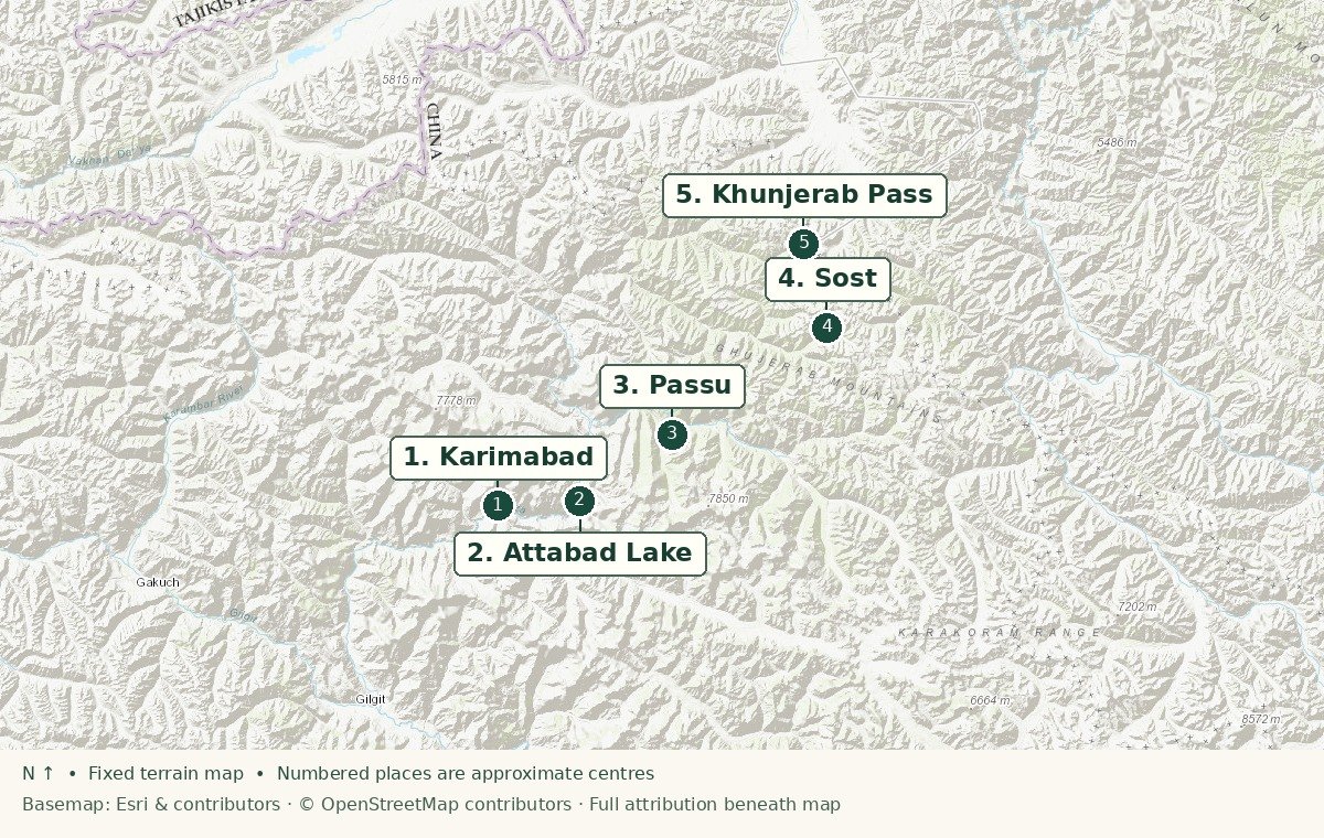
- 1Karimabad
- 2Attabad Lake
- 3Passu
- 4Sost
- 5Khunjerab Pass
Sources: Esri, HERE, Garmin, Intermap, increment P Corp., GEBCO, USGS, FAO, NPS, NRCAN, GeoBase, IGN, Kadaster NL, Ordnance Survey, Esri Japan, METI, Esri China (Hong Kong), © OpenStreetMap contributors, and the GIS User Community.
The experience
What the visit is like
Through upper Hunza
Drive via Attabad, Gulmit and Passu, leaving enough time for village stops and mountain views. Staying in upper Hunza or Sost avoids making a very long return from Gilgit.
The last ascent
From Sost, the terrain becomes more exposed. Your driver should confirm road and checkpoint access before departure, and you should carry identification and follow local instructions.
At the pass
Keep the stop brief if the altitude or cold affects you. The appeal is the scale of the setting, not a guaranteed open border or an international crossing.
Plan well
Practical details
Seasonal access
Do not rely on a fixed opening month. Snow, weather, border procedures and local restrictions can change the plan at short notice.
Altitude
The pass is around 4,700 metres. Take the ascent seriously, avoid strenuous activity on arrival and consult a health professional if altitude is a concern.
Transport
Use an experienced local driver, a suitable vehicle, a full tank and daylight. Keep a flexible return and do not continue on foot beyond permitted areas.
What to bring
Passport or required identification, warm layers, sun protection, water, snacks and cash. Mobile signal and services can be limited.
Good to know
Questions travellers ask
Can I cross into China from this visit?
A sightseeing visit does not imply a border crossing. Entry rules and crossing status are separate matters; verify them with authorities.
Should this be a day trip from Gilgit?
It is more sensible to stage in Hunza or upper Gojal and give the pass its own flexible day.
Keep exploring
Make it part of a journey
Use the related guide or itinerary to give this experience the time it deserves.
Editorial map and guidance are indicative. See local destination information and current UK travel advice. Map outline: Natural Earth.